There’s An App That Tells You What Landmarks You’re Flying Over

www.awol.com.au
A little while ago we revealed why we believe the window seat is the best seat on a plane and why most shutterbugs are drawn to it – and it makes sense. No matter how often you fly, there’s still some kind of romantic wonder to watching the world unfurl 30,000 feet below you. And while you’re wistfully observing, does it ever cross your mind to think what exactly is going on below you? Which town or city, mountain range or lake that you’re gazing down at? Thankfully, now there’s an app for that.

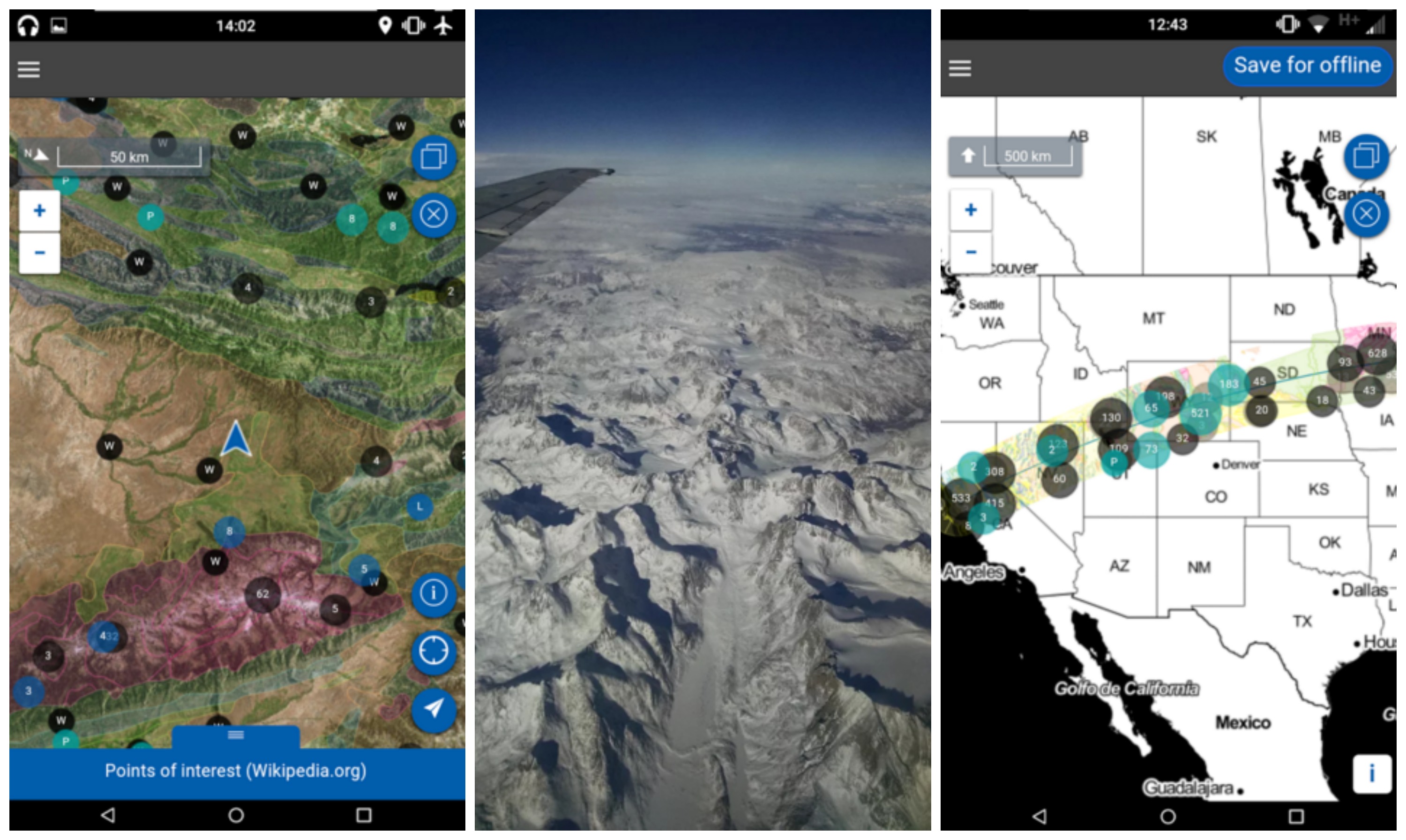
Flyover Country allows users to track their flight using GPS and figure our what features you’ll be seeing from your window seat. Your phone’s in-built GPS system helps pinpoint your exact location and altitude and then uses cached maps, Wikipedia articles and data to pinpoint details about your unique route – which means you won’t have to have Wi-Fi to use it.
Travellers can also use the app on road trips and hikes – basically any expedition that sees you pass a great distance.

Shane Loeffler, the brains behind Flyover Country, told the Smithsonian the idea came to him when he was on a long-haul flight: “I was looking down from an aeroplane window and seeing this huge landscape and these geological features, and [wondering about] the landscape I was flying over”. It’s a common occurrence on a flight, that’s for sure, so the app will be a pretty handy tool to have if you’re curious about the natural and man-made features you’ll be flying over.
Wondering about that bendy river below you? You can read about that. Curious about that epic looking mountain range that’s covered in snow? The app will tell you about that too.
Flyover Country is now available in the App store, and on Google Play. Happy exploring!
www.awol.com.au


