This New Map Shows San Francisco’s Hidden Shipwrecks
While San Francisco is a famous, beloved and popular tourist destination for countless reasons, many may not realise that beneath the hilly surface of the Northern California city, dozens of 19th century shipwrecks lie beneath.
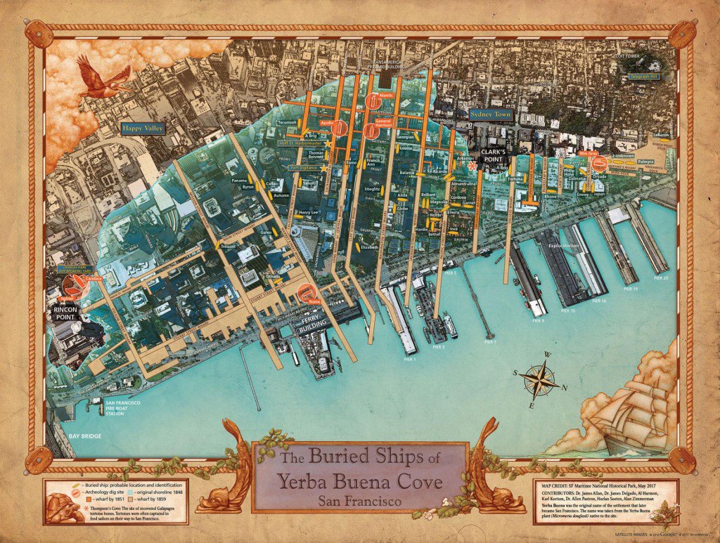
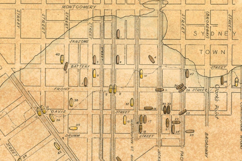
[related_articles]49445,27204,46908[/related_articles]A new map has been created which shows the location of hidden, forgotten San Francisco shipwrecks. Thanks to the San Francisco Maritime National Historical Park, the map, first created (and last updated) in 1963, has been updated for the first time ever.
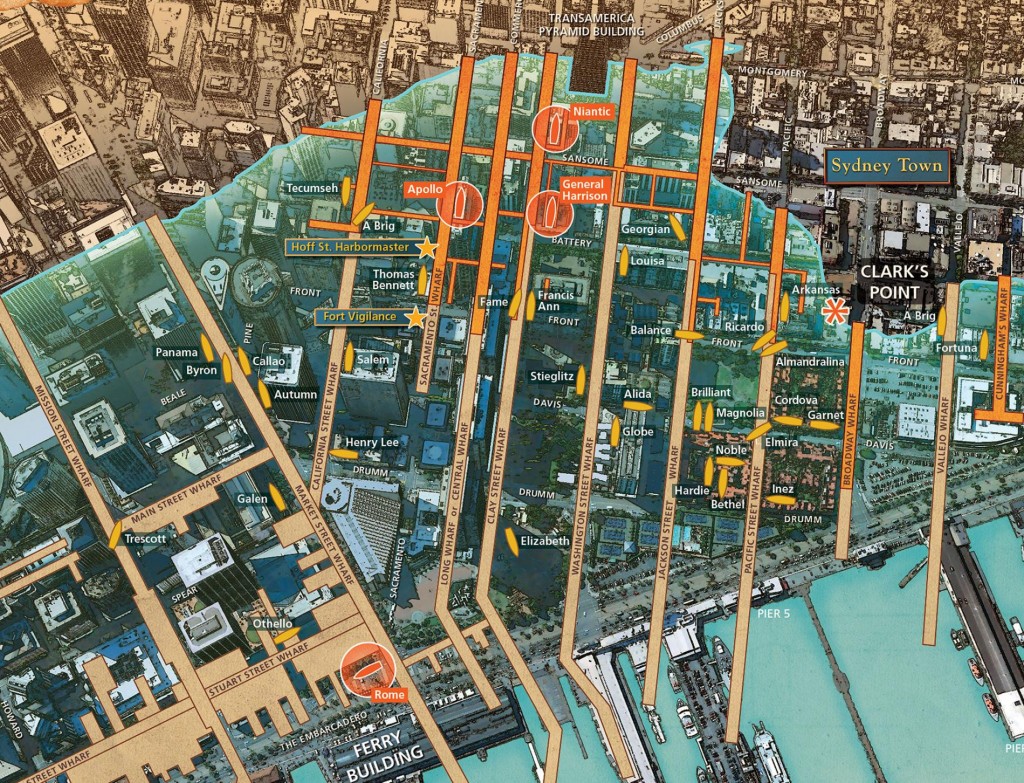
Mostly situated beneath the financial district within the city centre, the shipwrecks were the result of the 1800s California Gold Rush. Starting around 1848, countless hungry hunters, eager for the gold fields, arrived at Yerba Buena Cove to look for gold.
Many eventually abandoned their ships, though not always intentionally – some deteriorated over time, while others were deliberately vandalised or destroyed (some incredible photos from 1852 can be found here).

According to National Geographic, the entire Cove was eventually covered by landfill, and the wharf continued to grow, when individual people began extending parts of the pier on their own.
The new map of buried ships is an update on the one first released in 1963, with new findings and unprecedented detail having been discovered in the years since.
The maps have also been instrumental in providing vital detail to the history of the city; for example, researchers found remains of six ships that were destroyed in a fire in 1851. The deliberate fire was reportedly crafted by Charles Hare, a man who had employed Chinese labourers to strip the old ships for their brass, bronze and scrap wood to sell. Other artefacts, including Galapagos tortoise bones, have also been found along the way.
[related_articles]65452,65115,59312[/related_articles]The map is currently being finalised, after which it will be on display at the San Francisco Maritime National Historical Park.
[qantas_widget code:SFO]Want to see some incredible maritime history? Book flights to San Francisco. [/qantas_widget]
(Lead image: Charles Turner’s ‘Shipwreck’, Wikipedia)