The Ultimate Guide To Iceland’s Ring Road
Taking a trip to Iceland is like travelling back in time – the powerful and volatile conditions that the country experiences means that those who travel to the small island’s shores get a glimpse at a country literally in the making.
Vast glaciers cover mountain peaks, hiding active volcanoes beneath the sprawling ice. Geothermal energy bursts forth from the ground, resulting in more than a few natural hot springs and steaming mud pots. Mighty waterfalls crash through valleys and canyons, and the coast is cut with silent fjords battered by fierce, sub-arctic winds.
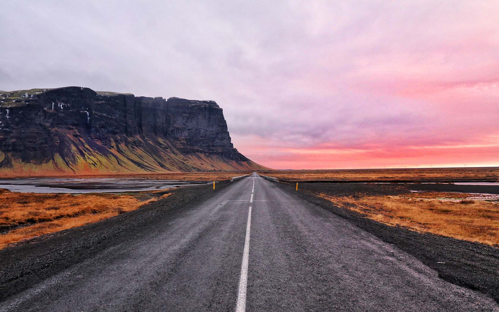
But the nature in Iceland doesn’t exist behind fences to be marvelled at; rather, you’re right in the middle of it. That means that the Ring Road that circles the country has all the makings of an absolutely sublime road trip. At just 1322km long, technically, you could charge around it in 15 hours – but, at the very least, you should take seven to 10 days to experience this magnetic country in all its glory.
The South Coast
Leave civilisation behind and enter the wilds of the country by heading south along Route 1 out of Reykjavik. Soon, you’ll enter the windswept grassy plains that mark the southwest corner of the coast, populated with a few small settlements and numerous farms set atop rolling hills.
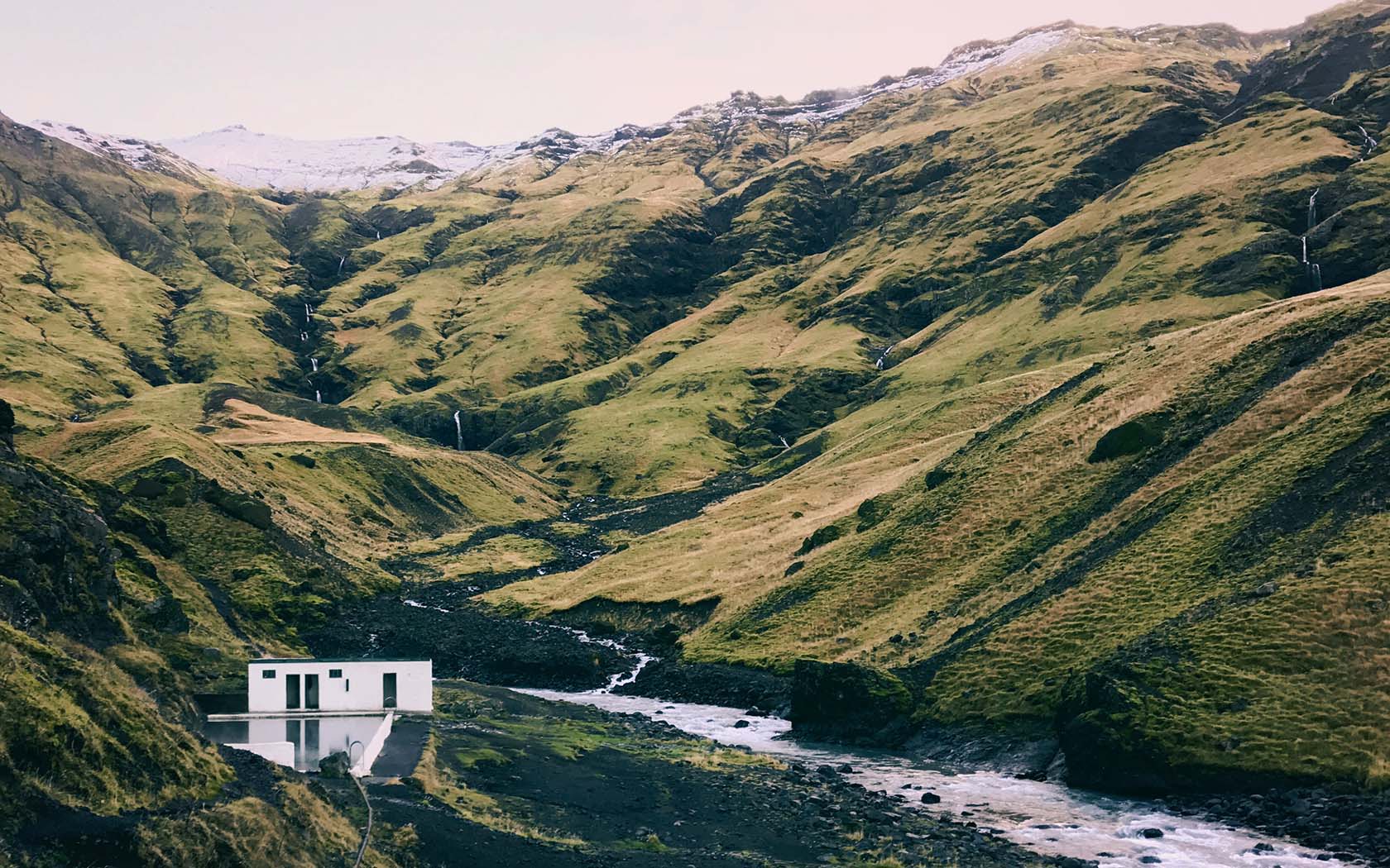
A great introduction to the country, make your first stop at the Reykjadalur Hiking Trail behind the town of Hveragerði (45 minutes drive from Reykjavik). The gentle trail leads you up into the mountains past steaming vents and scoldingly-hot mud pots to a naturally heated river with water running at 36 to 40 degrees Celcuys, so don’t forget your swimmers. It’s a 7km return journey, taking around three hours.
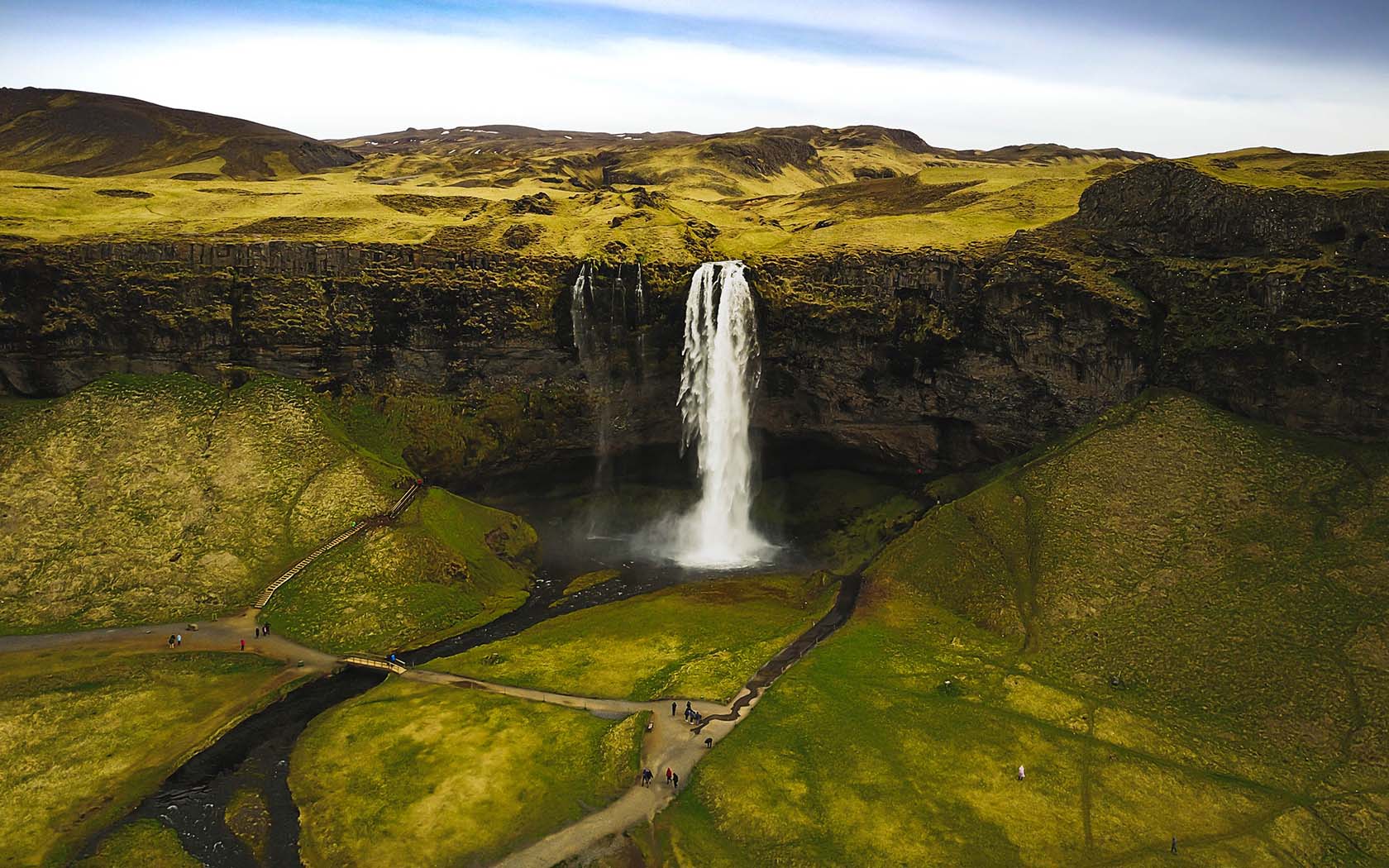
Further south towards the coast, the horizon fills with the glacier caps of Eyjafjallajökull and Mýrdalsjökull. Covering mountainous ranges close to the ocean and disguising volcanoes beneath, there are waterfalls streaming off both ice caps, with water cascading down the cliffs that separate the southern coast from the highlands. Make sure to check out Seljalandsfoss and Skógafoss, and avoid the crowds at the lesser-known waterfalls Gljúfrabúi and Kvernufoss.
As the road tracks closer to the coast, you’ll come to the charmingly attractive town of Vík, the biggest settlement in these parts and two-and-a half hours’ drive from Reykjavik. Surrounded by spectacular black sand beaches, it makes a great base for further explorations around the south coast.
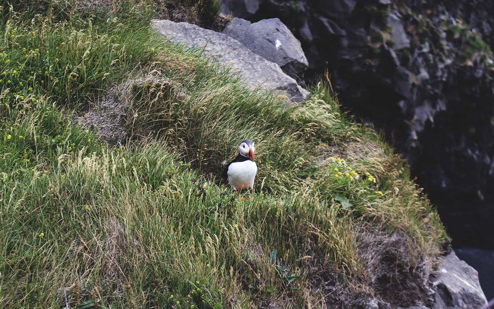
Make a quick stop at Dyrhólaey Peninsula for a staggering view over the impressive coast line in both directions and, from May to late August, keep an eye out for the puffins that nest on the cliffs.
Alternatively, take a trip to the volcanic island of Heimaey, a short 35-minute ferry ride south ($16.50/ 1380ISK) and home of the largest puffin colony in Iceland.
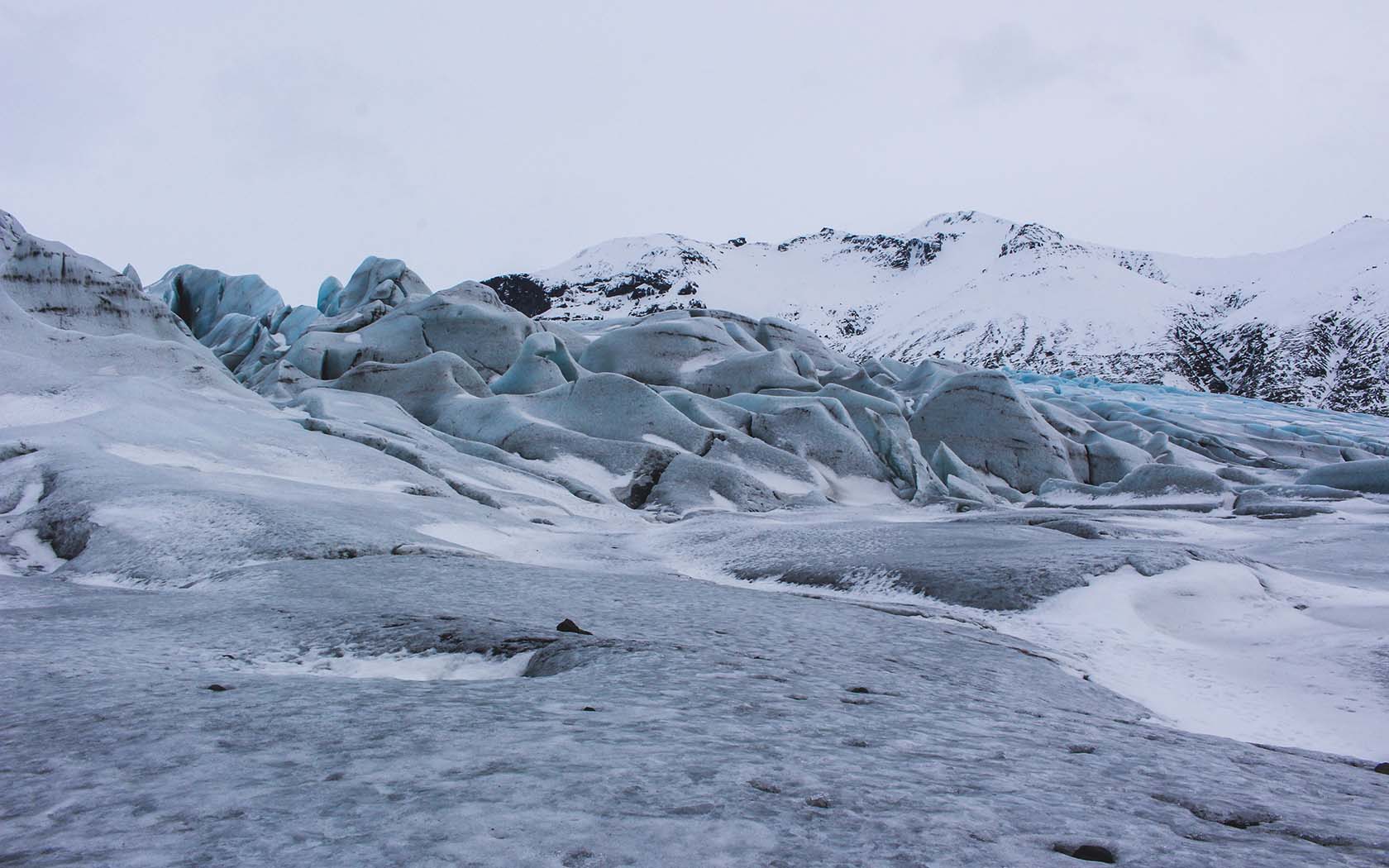
Further east, the landscape slowly turns into bleak tundras of black sand cut with icy streams of glacial run-off; signs that you’re nearing the biggest glacier in Europe, Vatnajökull. All traces of the population vanish as you near the ice cap, the inhospitable and infertile terrain deterring even the hardiest of Icelanders.
[related_articles]52004[/related_articles]Ninety minutes from Vík is a small alcove of nature in Skaftafell National Park, cosily nestled at the brink of the glacier and ideal for exploring the fringes of Vatnajökull. Another 50km east is the glacier lagoon Jökulsárlón, where you can watch large chunks of ice break off and crash into the water, slowly floating out towards the ocean before being washed up again onto the black sand.
East Iceland
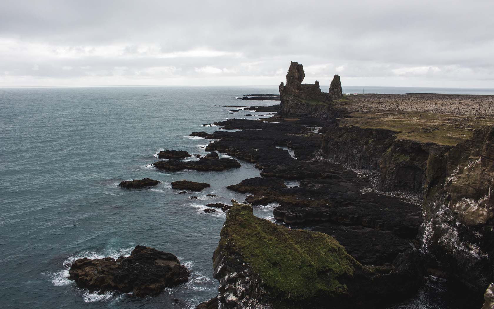
The east of Iceland is characterised by a smattering of small fishing villages strung out amongst the giant fjords, separated by tall mountains that plunge down into the water. But the Ring Road cuts inland towards Egilsstaðir, bypassing most of the area altogether, so it pays to take the scenic detour from Breiðdalsvík down Road 96, which leads you along the eastern coastline.
Once you hit the town of Fáskrúðsfjörður, continue down Road 955 to loop around another fjord towards Reyðarfjörður, where Road 92 links you back up to Egilsstaðir. It only takes around an hour longer than if you’d stayed on the Ring Road.
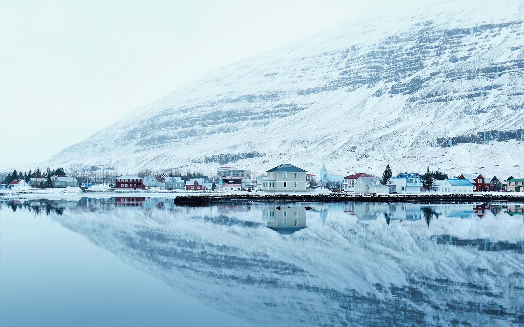
Egilsstaðir, with no real town centre or attractions, is overshadowed by the coastal town of Seyðisfjörður at the end of Road 93. This attractive bohemian hamlet is colourful and energetic, connected to Denmark and the Faroe Islands by Ferry.
There are a number of cafes, restaurants and galleries in Seyðisfjörður, and it’s very easy to while away a day here. There’s a world-class sushi joint as well, so head to Norð Austur and order the chefs’ choice – 15 pieces for $53 (4500ISK).
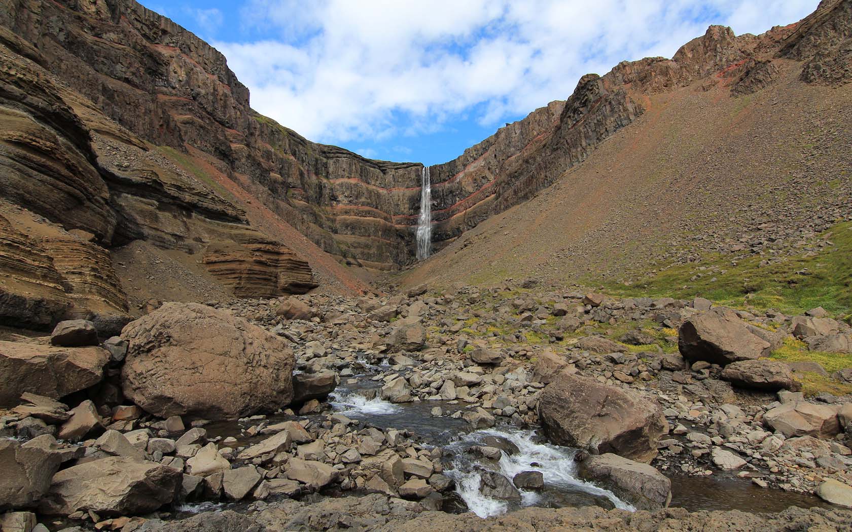
Another popular detour is inland towards the lake of Lagarfljót; it has Iceland’s largest forest Hallormsstaðaskógur on one side, and a car park is the beginning of a short hike towards the jagged interior and Hengifoss, one of the tallest waterfalls in Iceland, on the other.
North Iceland
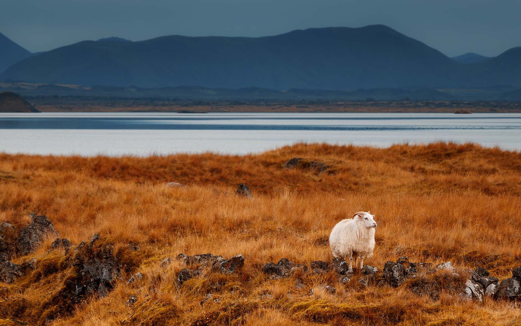
With massive glacial rivers draining out towards the north coast through lava fields, craters and wild canyons, the north is where you’ll feel the full force of Iceland’s nature.
Most of the action is centred near the Lake Mývatn area, 175km from Egilsstaðir. Surrounding the beautiful lake are a number of secret caves, volcanic formations, and hot springs, the most famous of which is the Mývatn Nature Baths, the north’s answer to the popular Blue Lagoon.
You can also check out the Game of Thrones shooting location, Grjótagjá cave, while you’re here.
Before you reach Lake Mývatn, however, turn up road 682 (approximately 142km from Egilsstaðir) towards Dettifoss; Europe’s most powerful waterfall. A massive 500 cubic metres of water rush over the edge of this waterfall every second, creating a roar like nothing else.
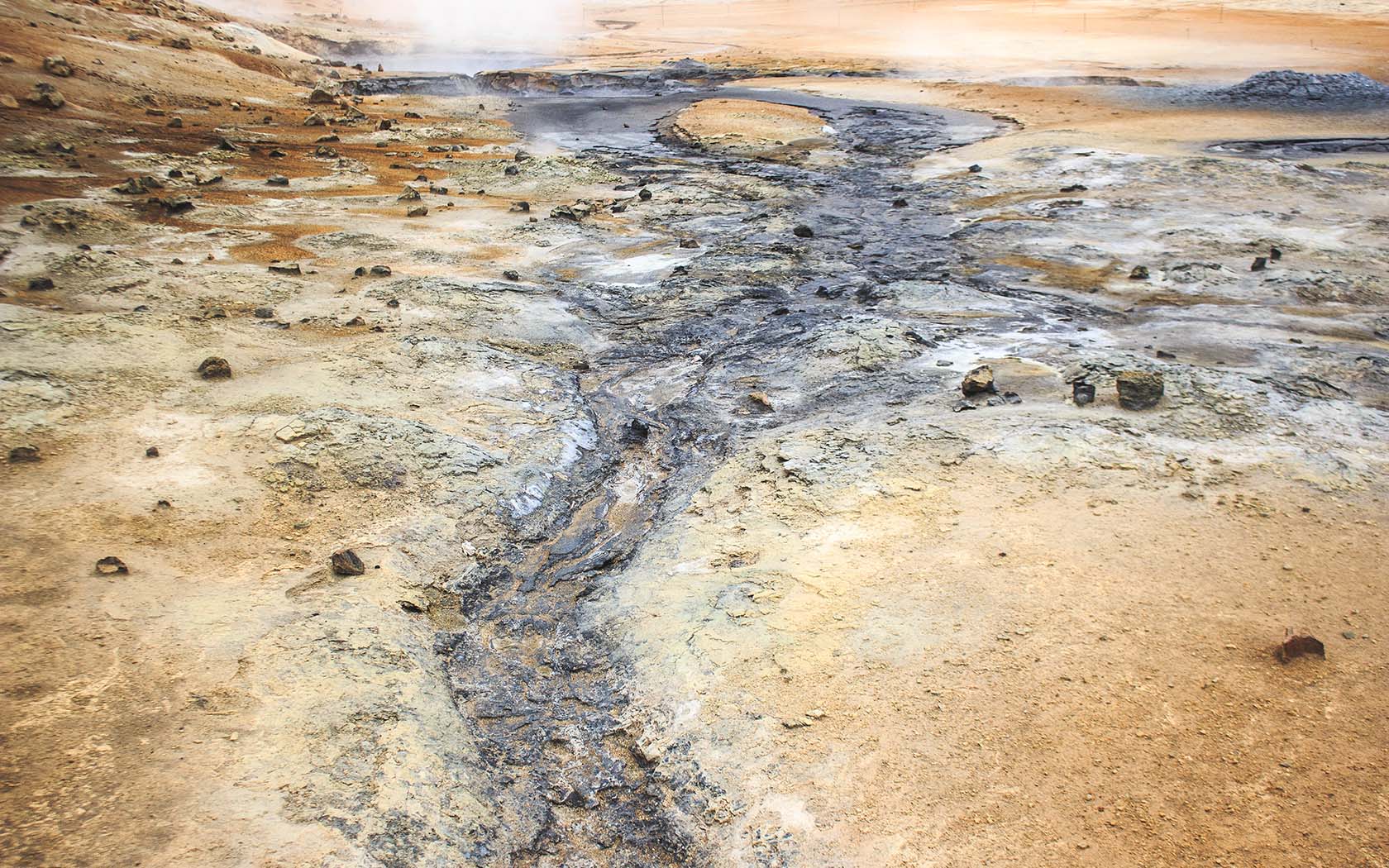
Another 20 minutes back along the Ring Road and you’ll find yourself in Hverir, an arid geothermal area, and opposite that an unmarked road leads towards the Krafla volcanic caldera where you can walk through a large lava field, still scalding in places, as well as explore the rim of the ancient volcanic crater Víti, which is filled with electric blue water.
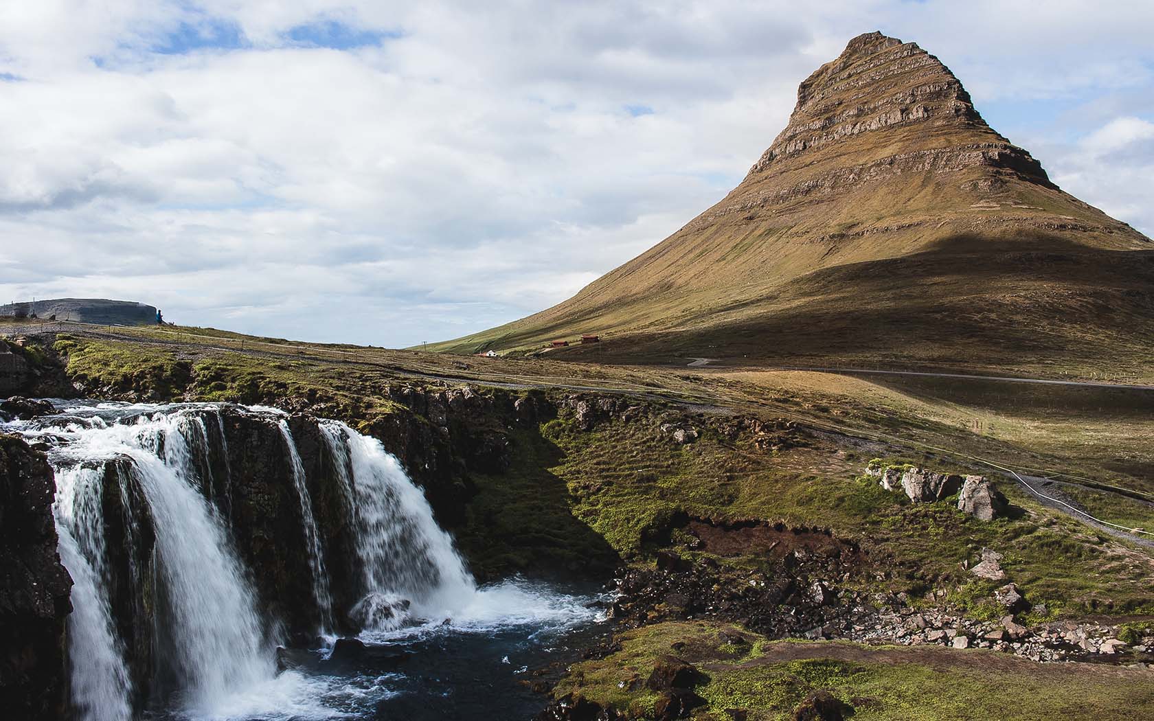
A further 91km west from Mývatn is the town of Akureyri, a beacon of civilisation in the north and second-biggest city in the country behind Reykjavik. Aside from the waterfall Goðafoss, there are no other major stops.
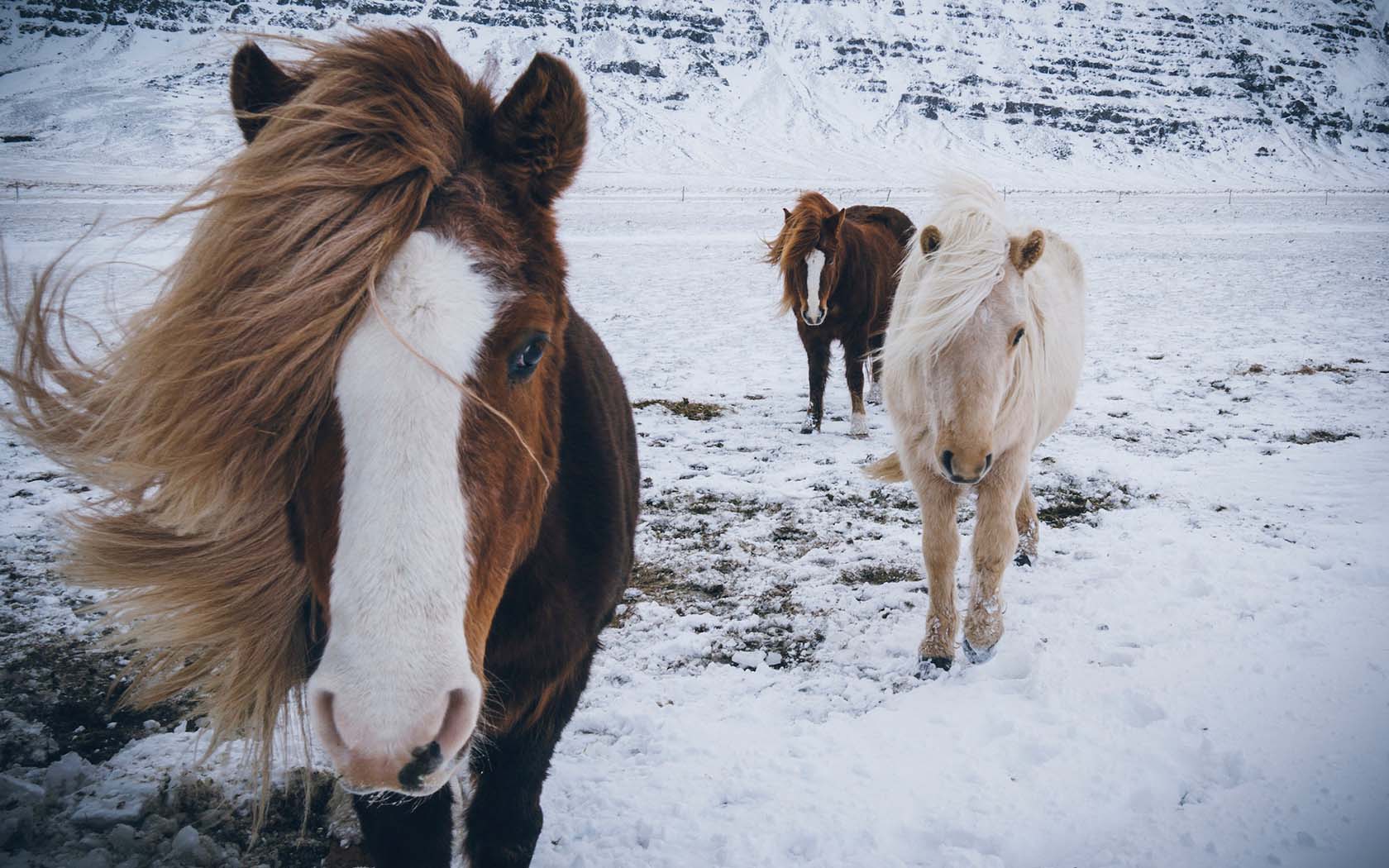
Akureyri is a fun town to spend some time in, and a good place to organise a number of tours in the surrounding regions, such as horse riding, quad bike tours or 4×4 adventures into the highlands.
West Iceland
From Akureyri, the Ring Road winds through the mountains and emerges onto the plains of Western Iceland. With no obvious attractions along this part of the Ring Road, it’s a good region for enjoying the scenery as you track back towards Reykjavik.
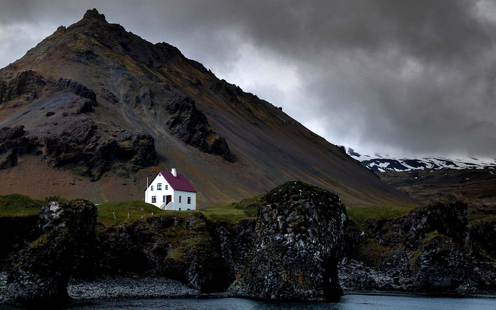
The Snæfellsnes Peninsula, just over an hour’s drive north from Reykjavik, is probably the most popular region in the West. Drive to Borganes and then up road 54, approaching the peninsula from the south. Divided by a mountain ridge that cuts through the centre, at the very tip is the glacier Snæfellsjökull, which rests on top of a dormant volcano.
On the north side is Kirkjufell, Iceland’s most photographed mountain, and the bustling fishing town of Stykkishólmur is a great place to try some freshly caught seafood.
Driving back into Reykjavik can be exciting or depressing, depending on whether you’re staying in the city for a couple of days or flying back home. But don’t fret – because, like most people who visit, you’ll probably have already begun planning a return trip to the Land of Fire and Ice.
(Lead image: Rory Hennessey)
[qantas_widget code=REK]Check out Qantas flights to Reykjavik.[/qantas_widget]